
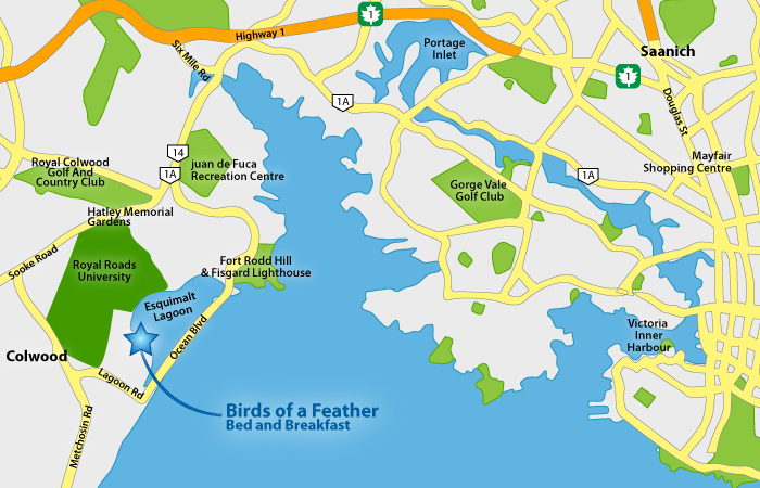
Directions by car to Birds of a Feather from Highway 1
206 Portsmouth Drive, Colwood, BC
- follow Hwy 1 take the Colwood / View Royal exit #10 if going northbound (exit 11 if driving southbound), then turn right onto Hwy 14 at the Six Mile Pub (aka Sooke Rd or Old Island Hwy),
- turn left at the 6th traffic light on to Ocean Blvd. (light at Wendy's)
- turn left again on to the first road to the left which is the continuation of Ocean Blvd
- continue for about 5 minutes through the forest and then alongside the ocean to Lagoon Rd.
- turn right on to Lagoon Rd. and up the hill to the tree line
- turn right on to Heatherbell
- the 2nd street down the hill is Portsmouth Drive - turn right - go to the end of the street and the last house on the water side (left) is 206 Portsmouth
Google Map Directions Click Here
Walk / cycle to RRU from Birds of a Feather
- go to the end of Portsmouth
- turn right on to Heatherbell and go to the end of Heatherbell
- 30 steps in to the driveway at the end of Heatherbell and enter the RRU gate to your left
- follow the path (dotted line on map below) and at the first junction bear to the right
- when you get to the paved T intersection turn left
- navigate your way to the RRU buildings to the right

